Boucle journée Lucenay pierres dorées azergues 29k

ophness
User
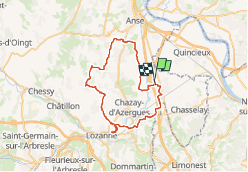

Length
28 km

Max alt
445 m

Uphill gradient
496 m
Km-Effort
35 km

Min alt
171 m

Downhill gradient
495 m
Boucle
No
Creation date :
2024-11-06 15:55:33.0
Updated on :
2024-11-06 15:55:34.161

FREE GPS app for hiking
 SityTrail
IGN / Geographical institutes
SityTrail Plus
The world is yours!
About
Trail of 28 km to be discovered at Auvergne-Rhône-Alpes, Rhône, Les Chères. This trail is proposed by ophness.
Positioning
Country:
France
Region :
Auvergne-Rhône-Alpes
Department/Province :
Rhône
Municipality :
Les Chères
Location:
Unknown
Start:(Dec)
Start:(UTM)
634726 ; 5083828 (31T) N.
Comments